GEOTECHNICAL ENGINEERING1
SLOUGH
HomeRoadwayFlexible pavement design

Flexible Pavement Design for Slough's Variable Ground Conditions

Sound ground. Sound decisions.

LEARN MORE

The ground beneath Slough changes more than most engineers expect. On the north side, towards the Colne Valley, thick alluvial clays dominate the soil profile. Move south of the Great Western Main Line and you hit the Taplow Gravel terrace, a much freer-draining formation. Designing a flexible pavement without mapping that transition is a fast track to differential settlement. We see it often: a roundabout near Slough Trading Estate behaves completely differently from an access road off the A4 into Cippenham. The pavement layers that work on gravel will pump and rut on clay if the subgrade isn't treated properly. Before committing to a structural number, we run targeted ground investigation—test pits through the made ground and CBR road testing at formation level—to calibrate the design to what's actually there, not what the desk study assumed.

A pavement is only as good as its subgrade assessment. In Slough, two boreholes 50 metres apart can show CBR values of 2% and 8%—and that difference decides the whole layer thickness.
Our service areas

Scope of work

The Thames Valley microclimate adds another layer of complexity to flexible pavement design in Slough. Winters here are wet but not deep-freezing—frost penetration rarely exceeds 350 mm, yet the real problem is prolonged saturation of the capping layer. The Langley Silt complex, mapped extensively across the borough by the British Geological Survey, loses bearing capacity sharply when moisture content rises above its plastic limit. A pavement designed to DMRB CD 226 on a dry August day can fail by February if drainage isn't addressed. We specify granular capping thickness based on soaked CBR values measured on-site, not on default tables, and we tie the grain-size analysis of the subbase to permeability targets that keep the formation dry. Where the water table sits high—common in the Chalvey and Salt Hill areas—the Atterberg limits of the subgrade tell us whether lime stabilisation will work or whether a full geogrid-reinforced capping is needed.
Flexible Pavement Design for Slough's Variable Ground Conditions
Technical reference — Slough

Local geotechnical context

The British Geological Survey 1:50,000 Sheet 269 maps Slough across four distinct superficial deposits: Langley Silt, Taplow Gravel, Alluvium, and pockets of Head. The Langley Silt is the most troublesome—a brickearth with metastable structure that collapses on wetting, classified as a Class 2C/2D frost-susceptible soil under BS EN ISO 17892. Where flexible pavements are laid directly onto untreated silt, we have recorded rutting exceeding 25 mm within three years, particularly on industrial estate roads subject to HGV channelisation. The Colne Brook floodplain adds a seasonal groundwater risk: winter levels can rise to within 600 mm of the surface, saturating the capping and halving the in-service CBR. Our designs mitigate this by specifying a separation geotextile between subgrade and capping, combined with a minimum 3% crossfall on the subgrade surface to drain water laterally into carrier drains. On deep alluvium sites near the M4 corridor, we also run CPT testing to detect soft lenses that could cause long-term consolidation settlement beneath the pavement structure.

Need a geotechnical assessment?

Reply within 24h.

Email: contact@geotechnical-engineering1.com

Relevant standards

DMRB CD 226 (Design for New Pavement Construction), BS EN ISO 17892 (Geotechnical investigation and testing), Series 800 (Specification for Highway Works – Road Pavements), Eurocode 7 – BS EN 1997-2:2007 (Ground investigation)

Reference parameters

ParameterTypical value
Design traffic (msa)0.5 to 80+ (residential to industrial)
Subgrade CBR range in Slough1.5% (alluvium) to 12% (gravel terrace)
Design standardDMRB CD 226 / HD 26/06 (UK trunk roads)
Typical asphalt thickness180 mm to 420 mm (full-depth construction)
Granular capping thickness150 mm to 600 mm (depending on subgrade CBR)
Frost index (Slough area)< 50 (negligible frost susceptibility)

Common questions

What is the typical cost range for flexible pavement design on a Slough industrial estate project?

For access roads and service yards on Slough's commercial estates, the pavement design and associated ground investigation typically fall between £1,290 and £4,120, depending on the length of the alignment, the number of design sections, and the depth of boreholes required to assess the subgrade. Projects crossing mixed geology—for example from Taplow Gravel into Langley Silt—require more investigation points and thus sit towards the upper end of the range.

How do you determine the CBR value for design on Slough's clay soils?

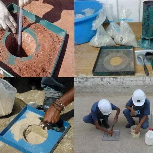
We measure CBR on-site using a dynamic cone penetrometer (DCP) at formation level, then correlate the results with laboratory soaked CBR tests on undisturbed samples. In the Langley Silt, soaked values often drop to 1.5–2%, which controls the capping layer thickness. We also run moisture content profiles to check whether the subgrade is at equilibrium or still consolidating after recent earthworks.

Which design standard applies to flexible pavements for Slough roads adopted by the council?

Slough Borough Council generally requires designs to follow the DMRB CD 226 framework, with supplementary guidance from the Specification for Highway Works Series 800 for materials and workmanship. For private industrial roads, we can adapt the design to a performance-based specification, but the analytical method remains the same. We also check frost susceptibility per HD 25, though the Slough area has a very low frost index.

Location and service area

We serve projects in Slough and surrounding areas.

View larger map